§ 1.1. Port Manatee study area
Port Manatee is located in the northwestern corner of Manatee County, close to the Manatee-Hillsborough county line. The Port lies between Tampa Bay on the west and U.S. 41 on the east. Vacant privately owned parcels of land lie to the south, along with property the Port has dedicated as a conservation easement.
The Port's access channel connects with the federal channel in Tampa Bay, which in turn connects with the Gulf of Mexico, a distance of approximately 24 miles. U.S. 41 and a parallel main line of the CSX Transportation (CSXT) railroad are both situated a few hundred feet from the Port's eastern perimeter and provide highway and intermodal rail access to the Port facilities. The Port's own Class III railroad features two new switcher engines and nearly 7 miles of track.
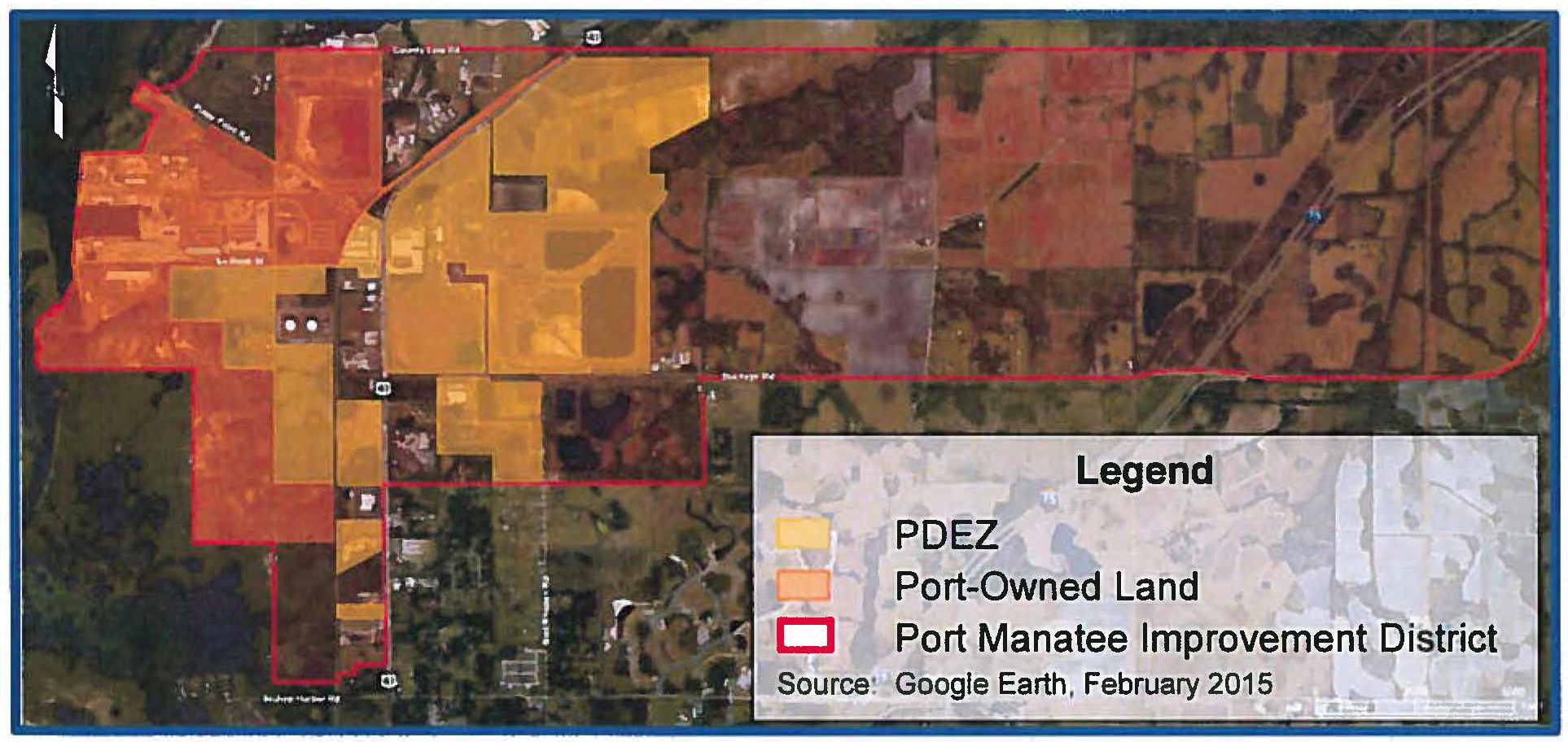
The Port-owned land within the established Port Development Improvement District are shown in Figure 1.1. The study area for this Plan also includes adjacent properties devoted to port-related uses as well as properties within the Planned Development Encouragement Zone (PDEZ). The PDEZ was created by Manatee County to facilitate preapproval of a variety of land uses for local property owners, as discussed later in Chapter 5.
Figure 1.1
PORT IMPROVEMENT DISTRICT

